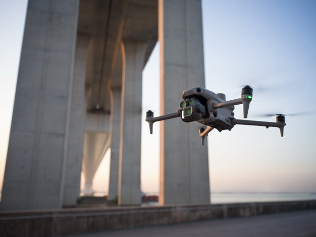
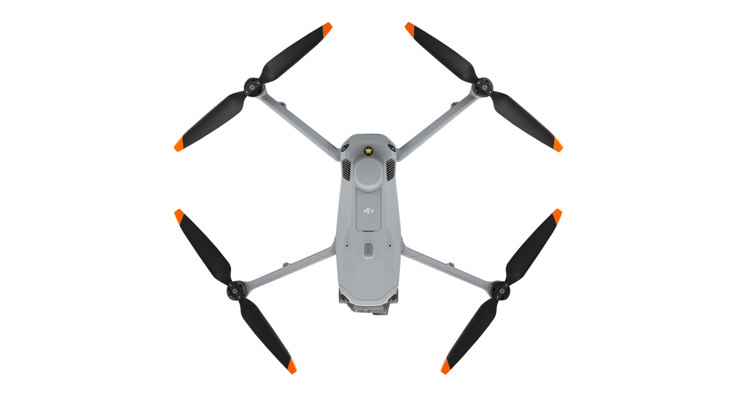
DJI Matrice 4 Thermal
DJI Matrice 4 Thermal
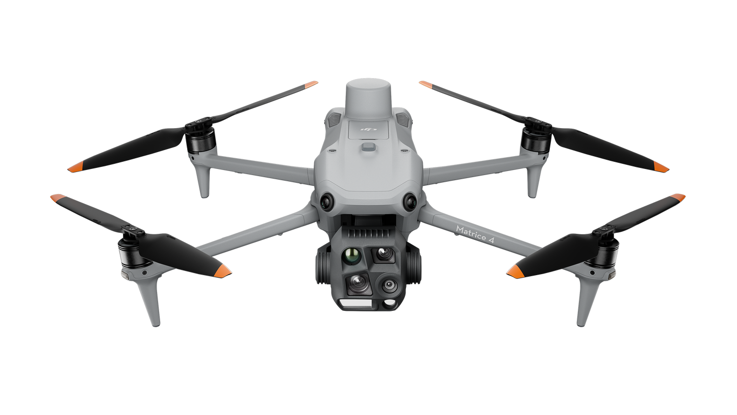
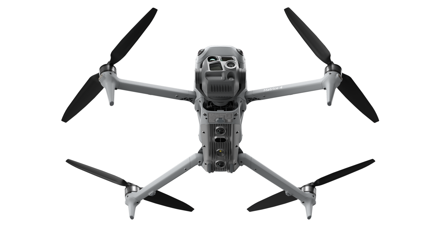
DJI Matrice 4 Series: Compact, Intelligent, and Built for Enterprise Applications
Introducing the DJI Matrice 4 Series, a cutting-edge multi-sensor drone lineup tailored for enterprise industries. The series features two models: the Matrice 4Tand Matrice 4E, both equipped with advanced AI capabilities and a laser range finder for precise detection and measurement.

With enhanced sensing technologies and AI-driven operations, these drones deliver safer and more reliable flight experiences. The series also comes with upgraded accessories, further enhancing functionality and performance.
-
Matrice 4T: Ideal for industries like electricity, emergency response, public safety, and forestry conservation.
Matrice 4E: Specially designed for geospatial tasks such as surveying, mapping, construction, and mining.
Unleash the potential of your enterprise operations with the DJI Matrice 4 Series!
DJI Matrice 4T: Advanced Drone for Public Safety and Inspections
The DJI Matrice 4T (M4T) is designed to elevate public safety operations and inspection workflows with cutting-edge AI capabilities, multi-sensor integration, and enhanced flight safety features.
Key Advantages for Public Safety and Inspections
AI-Driven Precision
- Advanced Detection: Built-in AI models can identify humans, vehicles, and more during drone operations, with open support for third-party platform development.
- Accurate Measurements: The laser range finder offers precise distance detection, target coordinate measurements, pin-pointing, line drawing, and area calculations. Highlight specific ground areas with ease for enhanced observation.
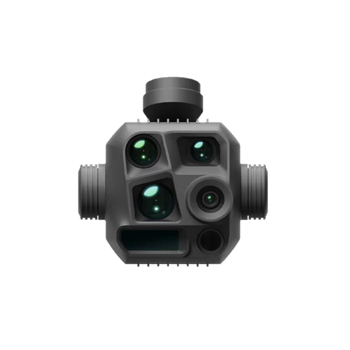
Multi-Sensor Capability
- 6-in-1 Sensor Integration: Includes wide, medium tele, and tele cameras, a laser range finder, an infrared thermal camera, and NIR auxiliary light.
- Exceptional Zoom and Thermal Imaging: Up to 112x zoom allows car plate visibility from 250 meters. Ultra-high-resolution infrared imaging ensures superior thermal quality.
- Enhanced Visuals: Full-color and black-and-white modes improve low-light clarity, while electronic dehazing and foreground stabilization deliver sharp, steady images for inspections.
Safer Flight Operations
- Resilient Navigation: Anti-GNSS interference and vision positioning ensure safe operations in low-GNSS and low-light conditions.
- Extended Range: Operate with confidence using an FCC transmission range of up to 25 km.
Upgraded Remote Control
- Bigger and Smarter RC Plus 2: Features a 7.02-inch, 1400-nit display for effortless operation. Fully compatible with the Pilot 2 app and FlightHub 2 cloud synchronization for streamlined mission management.
Recommended Application Scenarios with M4T
1. POWERLINE INSPECTION
- Scenario: Transmission tower, distribution line, and pole.
-
Advantages:
- Improved obstacle avoidance at the powerline level.
- Medium tele and tele cameras for high-quality visual imaging.
- Flexible zoom with a combination of three different lens cameras.
- Smart photo and spotlight for low-light, night inspections.
- 4G-enhanced transmission for extended inspection range.
2. PUBLIC SAFETY
- Scenario: Law enforcement, search and rescue.
-
Advantages:
- AI-assisted detection for humans, vehicles, and boats, with alarms.
- FlightHub 2 remote control saves pilot resources on-site.
- UHR infrared imaging for superior thermal quality.
- Cruise and observed views reduce the need for frequent pilot RC operations.
- Night scene mode and spotlight for night operations.
- Pinpointing and sharing for search and synchronization.
- Speaker functionality for communication and reminders.
- Relay feature for extended range in mountainous areas.
- Line and area drawing capabilities for distance and area calculations.
- Infrared camera for high-temperature spot detection.
- Low-noise propellers and discrete mode for sensitive operations.
3. RENEWABLE ENERGY
- Scenario: Solar panel inspection.
-
Advantages:
- Thermal imaging for high-temperature spot detection.
- Precise pinpointing of defective panel coordinates using the laser range finder (LRF).
4. OIL AND GAS
- Scenario: Pipeline inspection.
-
Advantages:
- Thermal detection for pipelines and monitoring oil theft.
5. FORESTRY
- Scenario: Forestry protection.
-
Advantages:
- 25km transmission with relay-based range extension.
- Zoom cameras and thermal video for fire prevention.
6. BRIDGE INSPECTION
- Scenario: Bridge inspection.
-
Advantages:
- Vision positioning for inspections in low-GNSS environments.
- Spotlight for low-light inspections, especially under bridges.
7. BUILDING INSPECTION
- Scenario: House inspection.
-
Advantages:
- Vision positioning for operations in low-GNSS environments among buildings.
The DJI Matrice 4T combines intelligent features and robust technology, making it the perfect choice for professionals in public safety, infrastructure inspection, and beyond.
Couldn't load pickup availability